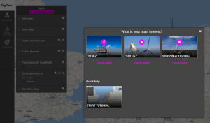
Can we make the spatial plans of the North Sea and their effects more transparent by combining data and using advanced processing techniques? That is the question that is central to the Digitwin North Sea project.
Although not very visible to the people on land, it is extremely busy on the North Sea. There must be wind farms, there are very busy shipping lanes, the fishing sector wants to be able to fish, internet cables, electricity, oil and gas pipelines need space and there is also nature that we must maintain or restore. For policymakers and users, it is an almost unsolvable puzzle to make plans in which other interests are necessarily also hindered. The Digitwin North Sea wants to make the spatial plans for the North Sea and their effects on the environment more transparent and thus facilitate decision-making around the North Sea.
Go directly to the DigiTwin tools!

This browser tool provides insight into the impact of the construction of wind farms in the field of Maritime Spatial Planning.
Go to the DigiTwin card application

The Maritime Spatial Planning (MSP) Challenge simulation platform has been developed to provide policymakers, stakeholders and students with insight into maritime issues.
Go to the DigiTwin North Sea MSP challenge

With this platform, we want to be able to automatically convert data into a virtual or augmented world so that you can immediately see the effects of planning choices.
Go to the 3D data visualisation platform North Sea
How can the space in the North Sea best be distributed?
The partners Rijkswaterstaat, Deltares, Maris, Wageningen Marine Research, Breda University of Applied Sciences, Vrije Universiteit Amsterdam and information house Marien recognize this problem and offer their expertise to help. The Wallage process and the North Sea Agreement consider how space in the North Sea can best be distributed. This is of course a political process, but there are also many technical, financial and environmental advantages and disadvantages to all the possible choices, in which Digitwin Noordzee can help.
In recent years, experience has already been gained with computer models and digital twins to help policymakers and the public make decisions and see what the consequences of those decisions are. These systems also have their limitations, because we do not know whether a complex system such as the North Sea will really behave as the model indicates. To indicate this uncertainty, we often see the term “serious gaming” pass by.
Digital replica of the North Sea
With the Digitwin North Sea, we want to take a step forward and make it a state-of-the-art supporting tool for policymakers, stakeholders, scientists and citizens. It is a digital replica of the North Sea, which makes use of all the knowledge that is currently available, but is also flexible and leaves the responsibility with the policymaker and the stakeholders.
There will be various calculation models in the tool that can be switched on or off depending on the wishes of the users. The digitwin will then be used to facilitate the conversation.
Because a lot of nature is underwater and it is difficult for people to imagine how, for example, a dolphin or bird feels in the hustle and bustle in the North Sea, we are also going to make a virtual reality module. The idea is to get an even better impression of the situation in this way.
Open invitation: think along
We invite everyone to participate in this use case and/or in the digishape day, who:
- has experience with advanced processing methods such as machine learning or artificial intelligence; or
- has access to data or instruments that can be used in marine spatial planning.


